
Early New World Maps
by
Dr. Gunnar Thompson
Early Maps of the New World
The persistent academic argument concerning early voyages to the New World ends with an examination of the cartographic evidence. Maps that have been preserved in the collections of such distinguished archives as the Louvre (in Paris), the British Museum, and the Library of Congress are sufficient to prove that ancient seafarers as far back as the Roman Empire engaged in regular voyages to Ancient America.
The beauty of the ancient maps is that they contain precise details called “Diagnostic Geographical Markers.” These “markers” serve the same function as fingerprints found at a crime scene. These cartographical fingerprints contain unmistakable coastlines, geographical positions on the globe, references of longitude and latitude, proximities to identifiable mainland or islands, place names of cities or territorial titles (also called toponyms), and often text that identifies key features of topography, climate, vegetation, or native species of animals. Historical perspectives provided by the sequence of maps from a particular region are often sufficient to delineate sequential modifications of coastlines as subsequent explorers gradually improved the cartographical knowledge of a particular area.
The importance of examining the cartographical evidence is the realization that all the world’s maritime adventurers and merchants were actively engaged in exploring the world and taking advantage of valuable commodities from the earliest times that ships were capable of ocean sailing. Archaic academic notions that the New World was somehow isolated from Old World contact until after Columbus sailed across the Atlantic in an effort to reach China in the 15th century are based on a Eurocentric religious doctrine that was inherited from the Middle Ages. Most historians got their training at Medieval Church universities; and it was the belief of learned elders in these institutions that the sole purpose for having a Chronicle of the Ages (that is, “history”) was to document the spread of the “One True Religion” around the globe. Modern scholars would do well to abandon this myopic mental baggage, because the survival and prosperity of our species depends upon making an accurate appraisal of where we have come from in the past and where we need to be heading in the future. All the world’s peoples (and all religions) played a role in the past; and together we must build the pathway into the future.
Incremental migrations across lakes and calm coastal regions were taking place by nomads using logs or rafts by a million years BC. These “Stone Age People” traveled between Africa and Asia. By 50,000 BC, the aboriginal peoples of Indonesia sailed rafts to Australia; and maritime hunters from Siberia paddled or sailed dugout canoes along the coastal isles of Alaska, California, and Mexico. Some brazen hunters reached South America by 30,000 BC. By about 4000 BC, civilized peoples in Sumer, India, and China had developed watercraft suitable for roundtrip voyaging. It is at this point in the human story that the notion of “continental isolation” quickly evaporates.
Indo-Sumerian and Chinese legends about transoceanic voyaging date back as far as 3000 BC. Domesticated plants were carried across the seas. New World maize (or “Indian corn”) shows up in the archeological record of Egypt dating as far back in time as 3000 BC. It can be identified on ceramic pots from the Naquada Phase of pastoral villages at campsites along the Nile River. By 1500 BC, the New World plant was featured on temple murals at Deir al-Bahri near Thebes.

Maize or Indian corn at Temple of Pharaoh Hatshepsut, Deir al-Bahri, 1470 BC
Howard Carter’s illustration of Grain from Punt, Egypt Exploration Soc., c. 1900

For additional examples of New World maize in Egypt, Mesopotamia, India, and literary as well as Internet sources see: Gunnar Thompson, Ancient Egyptian Maize, Misty Isles Press/Lulu.com (2010). Scholars from the Egyptian academic community suggest that these maize-like plants actually represent “lettuce.” The Land of Punt was described as the Abode of the Sun that was situated west across the Great Ocean.
Phoenician & Greek Maps of the World
Legends from Classical Greco-Roman featured the ancient Cronus People who, it was said, “measured the earth.” Presumably, they made a map of the world that was based on measurements of longitudes and latitudes at ports all across the globe. The inheritors of the ancient world map were Phoenician mariners who served as the principal carriers of transoceanic commerce from 1000 BC to about 200 BC. Roman victory at the culmination of the Punic Wars in 146 BC ended Phoenician dominance of trade on the Mediterranean Sea and across the Atlantic Ocean to Mexico. Survivors of this conflict fled to the Eastern Seaboards of North America, Mexico, and South America.
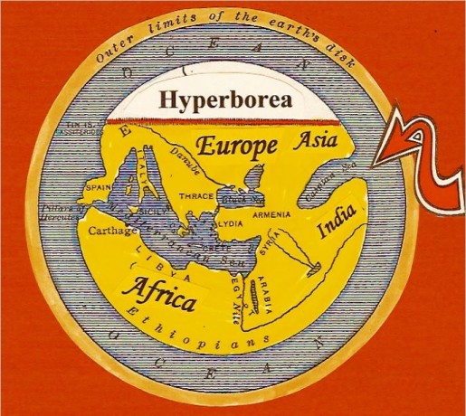
Hecataeus World Map (c.500 BC) portrays the “Old World” (Europe, Africa, and Asia) surrounded by water. Experienced sailors believed there was mainland beyond the ocean; however few mariners traveled beyond the major regions of commerce that are included on this map. The Western Caspian Sea (arrow) is indicated as a huge gulf that opens onto the ocean. This is an early representation of the Gulf of Mexico – where merchants obtained pineapples, corn, turkeys, pumpkins, chili peppers, gold, dyewood, tobacco, and other drugs. They brought in exchange iron tools, hemp rope, wine, oil, and textiles. Hyperborea was “the Land beyond the North Wind.” This included Labrador, Newfoundland, Nova Scotia, and the Eastern Seaboard of North America.
 New World Natives were dependent upon Phoenician merchants for iron and bronze tools. Top panel includes Phoenician bronze chisels; bottom panel features bronze tools from ancient Peru. Similar chopping tools (called adzes) used the same kinds of bronze blades in regions such as Egypt and Greece that obtained tools from Phoenicians as did the ancient natives of Mexico and Peru (bottom panels).


Eratosthenes’ Map extended the land-mass of Asia towards the east in about 194 BC. It also moved the Caspian Sea up to the Hyperborean (Northern) region; and it added the Red Sea east of Africa and the Arabian Sea. The lower continent – Alter Orbis (or “New World”) was intended to represent South America (arrow). Phoenician mariners and most educated people (which wasn’t very many) realized that earth was round. This knowledge wasn’t important for most people who were ordinary farmers. Modern historians have wrongly assumed that the so-called “Fourth Continent” was added simply to balance the globe. On the contrary, many Phoenicians and Greeks sailed to the overseas land below the equator. It is quite possible that geographers who plied their trade in Greece assumed that the southern continents of Australia and South America were joined together.
Roman World Maps
The leading scientific geographer of the Roman Empire was the Alexandrian Greek scholar – Cladius Ptolemy. His c.140 map included the Oecumene (or “Known World”) and a peculiar eastern peninsula that represented Peru. Evidently, Romans made frequent voyages across the Pacific Ocean to the Peruvian Coast where they obtained gold, copper, and exotic skins, feathers, and drugs. Ptolemy’s map was based on measurements of longitudes and latitudes of major ports that were frequented by Roman sailors. The geographer acknowledged that his map was based largely on previous details that were recorded by Phoenician mariners. He specified that longitudes could be estimated by observing the times of eclipses from two points on earth: a) from a baseline or “prime meridian;” and b) from a distant city or port. Local time was determined by using a clepsydra (water-clock), an hourglass, and a gnomon (or sundial). The difference in time (or hours) was expressed in distance on the earth’s surface (usually based on the mistaken assumption that earth was about 18,000 miles in circumference). Eratosthenes (a Greek astronomer) suggested a more accurate distance (24,000 miles); but the actual distance was not established among most geographers until the calculations of Amerigo Vespucci were confirmed in the 16th century.
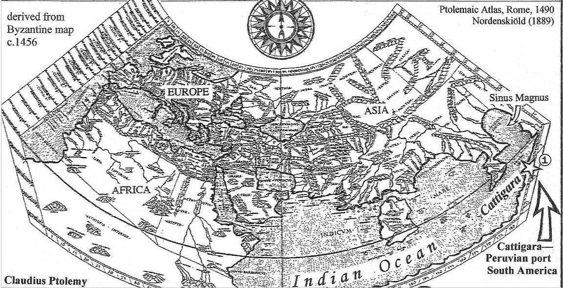
The Roman Empire Map shows a reasonably accurate Mediterranean Sea – due to the fact that this is where most merchant activity took place. Albion (or Britain) in the northwest corner is also fairly accurate. There was considerable commerce with this western bastion of Roman power, because the Roman aristocracy depended upon this island for the overseas import of tin, copper, tobacco, and such luxury items as chilies, corn, turkeys, and pineapples from Mexico. In the extreme east (arrow) the City of Cattigara was a major port where Romans obtained cocaine and gold. Most of the Renaissance European seafarers identified “Cattigara” as a major port along the Coast of Peru. Nearby is the modern-day City of Cajamarca. This is the City where Francisco Pizarro held the Inca King, Atahualpa, for a golden ransom. There was plenty of gold in Peru; and a lot of it was taken out in Roman ships. In exchange, Roman merchants traded iron tools, textiles, and drugs.
 Evidence of Roman contact with Peru includes an enormous Roman aqueduct that the French explorer Jean du Pouget encountered along the Rodadero River near Cuzco during his travels in the 1890s. A sketch of this architectural wonder was included in du Pouget’s travelogue from his South American expedition. Like many ancient ruins from Roman contact in the New World, the aqueduct has since collapsed.
 The geographer Macrobius made a new map for Roman merchants that shows the location of the principal western seacoasts of Florida and Mexico. This improvement over the earlier map by Eratosthenes was only possible by a reasonably accurate naval survey of the actual coasts of Mexico and Florida. Romans obtained considerable supplies of tobacco, corn, copper, tin, lumber, turkeys, and exotic luxury items for aristocrats. Most of this commerce was transported to Albion (or Britain). The tobacco was used by legionnaires in the British Isles where it helped them cope with the cold and moist climate. Thus, archeologists have found a considerable number of Roman smoking pipes at Romano-British archeological sites. One professional archeologist even identified the residue of “nicotine” in the smoking pipe.
 Roman tobacco pipe in Britain dating to about 100-300 AD. The 16th century botanist, Dodoen, identified “yellow henbane” as the Roman brand of New World tobacco.
 A considerable number of Roman artifacts have been found in Mexican territories and in the southeastern states. These include coins, amphoras (or wine casks), inscriptions, bronze castings, and sculptures. One Roman sculpture was found beneath a cement pavement inside a pyramid at Calizalahuaca (above, left). In addition to adopting classical arches from Roman architects, Mexicans practiced their own form of gladiatorial combat as a form of entertainment for the masses. Due to the poor supply of iron tools and weapons, the Aztecs devised a wooden sword called a macan. Sharp pieces of obsidian glass were inserted along the edges – thereby making these wooden swords very vicious and deadly in the Aztec arenas.
Early Chinese New World Maps
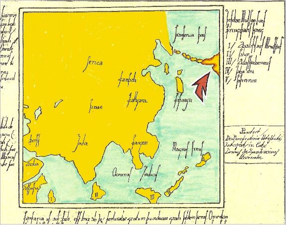
According to ancient Chinese legends, one of the “Immortal Emperors” who founded Chinese Civilization was Hwang-Ti (c.2697-2598). In about 2600 BC, he sent explorers all across the globe in order to investigate the overseas peoples, geography, and resources. Accounts from all these explorations were assembled in a great encyclopedia called Shanhai Jing (or Book of Mountains & Seas). It was recorded on bamboo paper that was repeatedly recopied and handed down to subsequent generations. Some of the volumes have survived – after being copied and recopied almost a hundred times. Most modern scholars regard the Shanhai Jing as being fictional. Nevertheless, several geographical features on a map that was reprinted in Korea during the 19th century seem to have been based on actual observations that were made by ancient explorers.
China was portrayed on the Shanhai Jing Map as the eastern-most empire of the Old World continents. The map identified an enormous “ring continent” that completely surrounded the central mainland. Subsequent maps by Hindu and Muslim geographers also portrayed earth in this manner. The disc-shaped maps reveal that most ancient geographers realized that earth is round. There was a land called Fu Sang (meaning the Eastern Land or the Land of the Sunrise). It was situated directly across the Eastern Sea (or Pacific Ocean). This territory corresponds to Mexico and California. Towards the east of Fu Sang, the map indicated the presence of “Bright Chasm Mountains.” This could be an early reference to the colorful Grand Canyon of the American Southwest. Northeast of China on the ring continent we find “Measuring Skies Mountains” in the approximate location the towering peaks of Alaska – Mount McKinley and Mt. Hayes. Nearby, the geographer noted the presence of “giants” – which could be a reference to the fearsome grisly bears. In the South American region of the Andes Mountains, the caption on the map reads: “Depending on Heaven Mountains.” So, there is a general correspondence between features on the map and actual topography.
 19th century Korean maps called Ch’onhado (or Tien xia tsu in China) portrayed the world in a manner that seems to follow the itinerary or geography of the Shanhaijing (Book of Mountains and Seas, c.1000 BC). The central region (yellow) represents the Old World continents with the central circle signifying the Chinese Capital. The ring continent (orange) is a schematic portrayal of mainland of mountains and shores across the seas. Fu Sang – meaning Land of the East or Land of the Sunrise – represents the American West Coast. This overseas territory was also known in China as “the Isle of Immortals.” It was roughly the equivalent to the medieval European concept of an Earthly Paradise.
Considerable numbers of Chinese symbols and artifacts have been found all along the American West Coast. These relics bear testimony to enduring trade across the Pacific Ocean. Major Chinese migrations to ancient America took place following the triumph of the Zhou People over the Shang Dynasty in about 900 BC. In Mexico, the arrival of Chinese refugees from this conflict was called “the Great Migration” in Mayan folklore. A second migration took place between 500 and 300 BC following the “Warring States” conflict. This second wave of Chinese immigrants was known as “the Lesser Migration.” One result of this new influx of people and ideas from the Orient was the introduction of the hallmark Yin/Yang Symbol and a related complex of religious symbols that the author has identified as “the Omnibus Power Sign.”
 Between 500 and 300 BC, Chinese religious symbols, the Yin/Yang, Zhou writing, pottery, jade carvings, and the Omnibus Power Sign suddenly appeared along the shores of Western Mexico. Archeologists have called this proto-Mayan culture “Izapan” or “Tajin.” This was an entirely new cultural development in Mexico, because there were no antecedents in the Olmec Empire. This Heartland of Fu Sang was also the habitat of a sacred plant called the ling-chih. It was the psilocybin hallucinogenic mushroom.
  The Tuxtla Jade Statuette (c.300 BC—300 AD) was found near the West Coast of Mexico. It is covered with contemporary Zhou Chinese tortoise-shell writing that was previously unknown in the region. It is conclusive evidence of significant contact between Mexico and China across the Eastern Sea (or Pacific Ocean). The statuette is in the National Museum of Anthropology and Archeology in Mexico City.
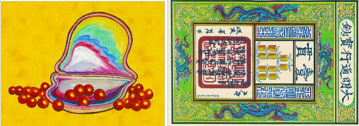
 Chinese jade coins with kanji writing and ocean-wave patterns were found by Mexican archeologists working at ruins of the ancient trading metropolis of Teotihuacan. They were dated to about 300—500 AD on the basis of radiocarbon tests.
 Following the migration of Taoist refugees from the fighting of the Warring States Period in China, Yin/Yang Symbols and dragon-scroll motifs from the Omnibus Power Sign became common in Mexican religious art. Power Sign Scrolls include scrolls and flames emanating from the sides of skulls and heads as a representation of human life-force and consciousness. Serpent-scrolls, instead of wings, represented immortality and the heavenly ability to rise above the earth. Scrolls issuing from mouths of sky-gods represented fertility, wind, and rain. Taoist priests who presented the new symbols to Mexico often wore pointed caps with flaps that were typical of Buddhist monks. This illustration is one of many artifact and symbol comparisons from Gunnar Thompson’s book about ancient voyages to the New World — American Discovery (2013).
Marco Polo’s Yuan Chinese Maps of the New World (1280-1299)
From 1271 to 1295, Marco Polo served as a field agent for the Polo Brother’s Spy Team that Pope Innocent IV sent to the Orient. They were instructed to infiltrate the Yuan Chinese regime of Kublai Khan. Church authorities were concerned about rumors that the Mongolian Emperor was arming his legions with gunpowder weapons called “Dragon-fire Lances” (or huolon in Chinese). Marco Polo called them harquebus (meaning “hook-barrel”) because the barrels had hooks beneath the firing chambers. The espionage team was expected to bring back to Europe examples of any useful inventions as well as maps that might reveal the locations of valuable resources. In the map below, we see Alaska and the Aleutian Islands – revealing the location of the breeding habitat of the valuable Pacific fur seals (arrow). Roman numerals (I, II, III, IV, & V) indicate the seaway leading to the Spice Islands.
This map from the “Rossi Family Collection” is a copy made by the Neapolitan Admiral, Roger Sanseverinus, who obtained the information from Marco Polo in 1297. According to a letter in the Rossi Collection, the map was subsequently copied by a Neapolitan notary service in 1555. That was a customary practice when valuable documents written on vellum (calfskin) were beginning to deteriorate due to old age. The date that this map was copied was confirmed by a radiocarbon test performed by the University of Arizona AMS Laboratory in 2007. The date indicated by the test was 1560 +/-100 years.
Marco Polo’s first overseas expedition in 1280-81 took him to the Kamchatka Peninsula north of Japan. On his second voyage, he sailed along the Northwest Passage to Baffin Island on a birding expedition for Kublai Khan. His assignment involved obtaining a brood of pure-white gyrfalcons. This variety of falcon was only available on Baffin Island and the nearby coast of Labrador. In Book III (Chapter 51) of his famous Travelogue, Discovery of the World, Marco Polo mentioned that his expedition passed by the Pole Star (Polaris) while heading north by compass. It was in this region of the Arctic Sea that Marco observed that “the Pole Star was behind him – and it had in part a southerly orientation.” In other words, Marco thought that his Chinese junk was still heading towards the North Pole – after passing by Polaris. He was surprised, because most geographers assumed that the Pole Star was situated directly above the Geographic North Pole. It was also assumed that the ship’s compass pointed towards a magnetic mountain that was located right beneath the Pole Star. This is the earliest documented report indicating that the region of the Pole Star and the location of the Magnetic Pole were separated by over a thousand miles. Given the scientific measurements of the locations of the Magnetic Pole between 1300 and modern times, the only place on earth were the expedition could have observed geomagnetic declination from True North was in the Arctic Sea near Baffin Island. In other words, we have conclusive evidence in the Travelogue that Marco Polo and the Chinese sailed along the Northwest Passage north of Hudson Bay. A sectional map that the Chinese made of Baffin Island was included in a document called “the Yale Vinland Map” dating to c.1440. Skeptics who assumed the Yale Map was a hoax mistakenly assumed the Chinese Baffin Island was Greenland. 
This copy of a Polo map in the Rossi Collection (by Sanseverinus) was authenticated by a radio-carbon test. The date indicated was 1560 +/- 100 years. The map reveals that the Chinese surveyed Alaska and the West Coast as far south as Mexico.
Upon returning to Venice in 1295, all the members of the Polo Spy Team were required to swear an oath that they would not discuss or write about their knowledge of New Lands or new Chinese weapons. Thus, Marco Polo was barred from revealing what he knew about Ancient America. It was only after he was captured in a naval battle with the rival Republic of Genoa that the Venetian Senate allowed him to dictate a book about his travels to China. This book lacked references to America’s West Coast; however, Marco mentioned that Chinese merchants made year-long voyages to foreign lands across the Eastern Ocean. He didn’t mention that the overseas land was a “New World.” Another reason why he didn’t promote the notion that a new discovery had taken place was because he had excellent reasons for believing that both the East Coast and West Coast of the so-called “New Land” were previously known to Romans – as well as many other ancient voyagers.
Marco did mention in his travelogue several New World imports that had reached the Old World and China. He noted plantations in Malaya that raised a valuable dyewood called brasilwood or brasilium. It was a commodity that was known to Romans as well as 13th century Italians who obtained cargoes from Irish merchants. Polo expressly stated that the plantations of brasilwood were different from the sappan redwood of Malaya. Another New World import was cochineal dye. It’s another red dye that was made in Mexico from the bodies of female cochineal bugs. By weight, the red dye was more valuable than gold. It was used to print Kublai Khan’s seal on paper money. The principal habitat of the cochineal louse was the Sonora Desert of Mexico that is adjacent to the Gulf of California. Marco Polo’s name for that Gulf was Vermilion Mare – that is, in English, the Vermilion Sea.” That enigmatic early name for the Gulf of California was used on most Renaissance maps. The name for the dye comes from the transport of the product by merchants from Cochin China or Vietnam. Another import from the Vermilion Sea that is mentioned in Polo’s Travelogue was red pearls. They were obtained by Japanese traders who sailed to California.
In his old age, Marco Polo seems to have disregarded his oath to remain silent regarding the New Lands across the seas; and he also “spilled the beans” with respect to the secret Chinese gunpowder weapons. He told his daughters (Fantina, Bellela, and Moretta) stories about his secret voyages; and they, in turn, informed all their female friends at the women’s educational salons in the Venetian Republic. In this manner, the secrets about muskets, California, the Vermilion Sea, and Florida helped to stimulate those inventors and visionaries who were responsible for igniting the Renaissance.
A Ming Dynasty map dating to 1418 incorporated Marco Polo’s earlier concept of California as being an island that was adjacent to the Vermilion Sea and west of the poorly charted mainland of Fu Sang. A second Ming Map c.1435 portrayed California as a peninsula. This modification and greater accuracy in the subsequent map confirms that the Ming Chinese were actively surveying the coastline of the New Land as part of their program to promote international commerce.

This section from the 1418 Ming Map that Beijing antiquarian Liu Gang located in 2002 is a combination of earlier Yuan Dynasty sea charts and newly-obtained information from subsequent Persian, Chinese, and European navigations. The Ming Chinese were able to draw better maps than Europeans at this point in time, because they sent exploratory fleets all across the globe; and they were anxious to incorporate new maps from foreign sources. Most Europeans were still encumbered with the antiquated belief that earth could only have the three Old World continents and a single ocean that were enumerated in Holy Scripture. Venetians, Portuguese, and English Franciscans were the first Europeans to break out of the self-imposed prison of religious ignorance.
There isn’t enough evidence to credit Marco Polo with naming California. However, his association with the Paisan romance-author, Rustichello, meant that his impressions from the “East Indies” were shared with literary colleagues who made a living by writing adventure-travel novels. Rustichello is the “ghostwriter” that the Genovese picked to write down Marco Polo’s Travelogue while the Venetian traveler was being held captive at the Del Negro Villa in Genoa. Rustichello’s associates were in the same cauldron of fanciful thinking from which the Spanish author, Garcia de Montalvo drew inspiration for a fanciful travelogue – Las Sergas de Esplandián (c.1493).
Esplandián was a bold explorer who, like Marco Polo, traveled across the Pacific Ocean to the Indies. His identification of “Island California” prior to the return of Columbus to Spain, and prior to the invasion of Mexico by Hernán Cortés, is one of the more amusing anecdotes from the file of unexplained imponderables.
Here is what Garcia Montalvo had to say about the new western coastline of America that no European (besides Marco Polo) had ever seen: “Know ye that at the right hand of the Indies, there is an island named California.” And so there was!
Famous Cartographic Anomalies Explained
Did Marco Polo “discover” Florida?
Well, he wasn’t the first European to actually find the subtropical peninsula; but he stopped by in the 14th century just long enough to make a map. Evidently, some wealthy Venetians intended to establish plantations for growing almonds, oranges, and quite possibly the valuable red dyewood tree called “brasilwood.” In 1932, a prominent American historian named William Babcock noted that “brasilwood” was listed in an inventory taken at the property of the Viscount of Leau at Rouen, France, in the 13th century (see “Notes” #1). The imported dyewood was also called “Irish wood” because it was widely known that Irish merchants brought the commodity to numerous European ports— including Hanfleur and Dieppe (where it is mentioned in port records).
 Brasilwood is a tropical American plant. It was a common import during the Roman Empire. It was used to color wool fabrics that provided a major source of income for English, Dutch, and Italian traders. Venetian bankers were keenly interested in gaining a cheap source of dyewood, because they were major financiers in the woolen industry. Most people were not very excited about wearing coats and dresses made out of the natural brown or cream-colored cloth. Thus, merchants could sell red woolens for a much higher price. Kings and queens were especially fond of “royal red” for uniforms of their troops; so there was an eager market for the red dyewood. In his Travelogue, Discovery of the World (1299), Marco Polo mentioned that “brasilwood” was different from the Asian variety of dyewood (called sappan wood).
According to most historians, Florida was discovered by the Spanish explorer, Ponce de Leon, in 1513. However, the simple fact is that Ponce actually called the land he explored Pascua de Flores – which is the Holiday Festival of Easter. The name “Florida” originated from Flora – the Roman Goddess of Springtime. It was said that she traveled west across the Atlantic Ocean during wintertime to a tropical paradise.
Evidently, Venetian merchants wanted Marco Polo to establish a suitable sailing route to plantations in the New World that were suitable for raising the tropical dyewood tree. He was sent on an expedition between 1307 and 1315 across the Atlantic Ocean. It was during this voyage that Polo used mapping skills he had learned in China to map the coastline of Florida and Brazil. These coastlines subsequently appeared on Venetian maps by Petrus Vesconte (c.1315) and Andrea Bianco (1436). Bianco’s map served as the prototype for a Portuguese mainland that was located directly west of Europe. It was called “Antilia.” This title for the overseas mainland is also found in the Rossi Documents as a reference for North America.
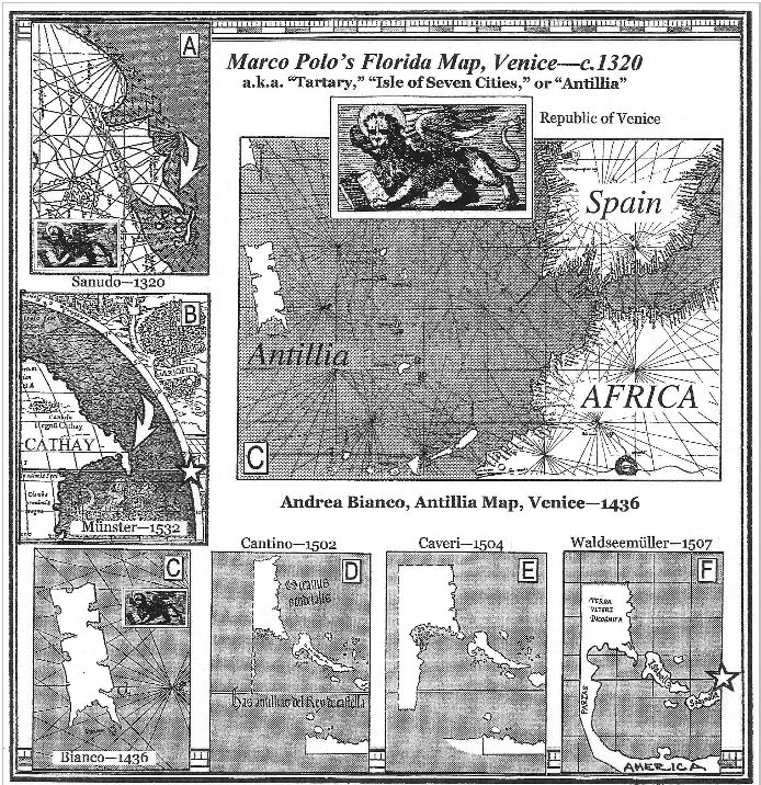
The upper left-hand frame (A) shows a new rectangular land with a southeastern peninsula that has been stuck onto the coast of China or Asia. On the map, it is called “Land of the Tartars.” This is a reference to land that was known to Marco Polo – as China or Cathay. However, this new land represents the Eastern Seaboard of North America that was also under the rule of a Tartar King by the name of Kublai Khan. In frame B, the up-dated version of the geography clearly shows the Peninsula of Florida. It reaches down to the Tropic of Cancer at about 23.5-degrees North Latitude. Andrea Bianco’s map (C) shows this same rectangular mainland completely surrounded by water and situated directly between Asia and Europe – which is precisely the situation of North America. Notice that the southeastern peninsula looks identical to Florida; and the name that is attached to the rectangle is no longer “Tartary” but Antillia – which Portuguese geographers said was the traditional name for mainland directly west of Europe. In other words, it was an early name for North America. In the sequence of maps D-E-F, we see how European geographers eventually evolved the rectangular mainland into North America. This gradual evolution resulted from the sequential increase in knowledge that was obtained by explorers. This progression confirms that Florida and the Eastern Seaboard of North America were surveyed by Marco Polo. The Venetian did not claim a “new discovery of a New World” for the simple reason that he certainly knew that the overseas mainland was previously known to Roman merchants as the Terrae Incognita (or “Unknown Mainland”). In other words: they knew there was mainland across the Atlantic Ocean – they just didn’t get around to making a thorough map. It was the source of such valuable luxury goods as tobacco, pineapples, hallucinogenic mushrooms, valuable red dyes, and cocaine.
Notes: 1. William Babcock, Legendary Islands of the Atlantic, New York: American Geographical Society, 1922, pages 50-53; Gunnar Thompson, Marco Polo in Seattle, Lulu, 2013, pages 174-78, 237. Did Columbus have a map?
Of course Columbus had a map; and it was a very accurate map with respect to the location of a mainland peninsula and islands (Florida and the Antilles) west of Europe. When Columbus landed on the shores of Hispaniola, he wrote in his Log Book that he had found land “precisely where it was indicated on the maps and globes he had seen in Lisbon.” Indeed, Columbus originally hoped to gain the support of King John of Portugal as a sponsor for his “Enterprise of the Indies,” but the King refused; so he turned to Queen Isabella of Spain to be his patron.
Numerous maps showed the Florida Peninsula and the Antilles Islands of the Caribbean Sea west of Europe. By the time Columbus sailed, previous Portuguese sailors had determined precisely the location of the Antilles and Florida 3,500 miles west of the Canary Islands. This geography was publicized by the Portuguese espionage agent, Martin Bahaim – who became a confidant of Columbus when he was in Lisbon 1480-84.
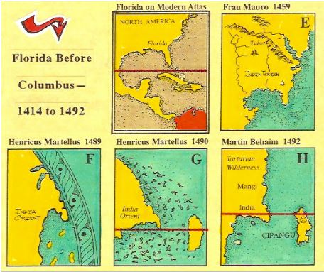 Prior to the Columbus voyage, at least nine maps showed the Florida Peninsula west of Europe. By 1490, maps by Martellus showed the Peninsula at the precise latitude and longitude west of Europe – reaching down to the Tropic of Cancer about 3,500 miles west of the Canary Islands. Behaim’s World Globe in Nuremburg in 1493 (H) identified the mainland that Columbus had “discovered” as being “India or China.” However, the secret Portuguese maps reveal that Behaim, King John, and several allies (such as the Venetians) knew precisely that Columbus had sailed to a “new world.” Actually, they knew that he had sailed to lands that were previously known to Romans, Phoenicians, the Chinese, and many North European merchants who sailed to “the New Found Land.”
Did English Franciscans make a map of North America in 1360?
One of the legends that endured from the 6th century era of King Arthur of Wales was that he sent several expeditions across the Atlantic Ocean in an effort to establish an overseas colony. This was an effort to preserve the Welsh Civilization in the face of barbarian invasions by Angles and Saxons from the east. Legends concerning the Colony of Albion in the New World were recorded on the 1569 world map by Gerhard Mercator. He noted that a pilgrim from King Arthur’s Colony had appeared at the Court of King Magnusson of Norway in 1264 – at which time he informed the Court that Franciscan friars trained at Oxford were mapping the land they called “North Norway.” It was further reported that a Dutch journalist, Jacob Cnoyen, had seen the friar’s account of his travels; and this manuscript, the Inventio Fortunatae (or “Discovery of the Fortunate Isles”) was presented to King Edward III in 1360. See notes, #2.
Most medieval church maps in Europe preserved the legacy of King Arthur’s Colony by identifying the presence of “Albion,” or “Great Albion,” directly west of Europe on the opposite mainland. It was also known that this territory – which was misidentified as part of Asia – was the major source of lumber and dried codfish that Norse merchants imported to Northern Europe. As the English were dependent upon these imports for their very survival, it was in their interests to learn as much as they could about the Western Provinces – be they called Albion, North Norway, or Vinland.

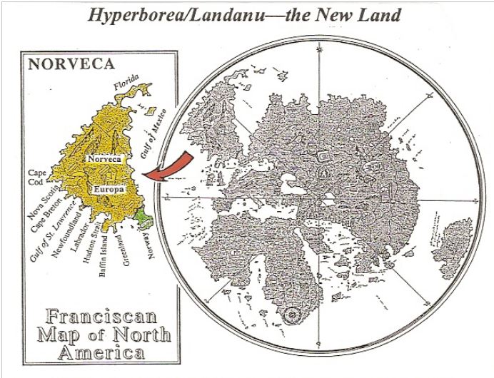
The English historian, Richard Hakluyt, determined that Nicholas of Lynn was the Oxford friar who was responsible for writing the Inventio Fortunatae. His map of the New Land northwest of Europe was given to the Venetian cartographer, Albertin di Virga, and it appeared in the northwest quadrant of a world map dating to about 1414. A photographic copy of this map is in the British Library; and it is also available from Wikipedia. See Gunnar Thompson’s book, Viking America (Lulu, 2012). Identifiable on this map are Florida, Cape Cod, Narragansett Bay, and other East Coast promontories. The region between Cape Cod and Narragansett Bay was later known as “Norumbega” or “North Norway.” It is evident that an overseas trade was established by King Haakon IV of Norway in 1262. This maritime trade was responsible for bringing millions of tons of dried codfish, lumber, furs, whale-oil, and luxury goods to European ports. In exchange, wheat, woolen textiles, iron tools, and beer were shipped to the west.
Commerce between Native Americans and European merchants made it possible to establish a bridge of common good will and prosperity that later enabled settlers from Europe to find new homes among the indigenous peoples. When Giovanni Verrazano sailed up along the East Coast in 1524, he reported peaceful encounters with “white skinned” natives and civilized people of diverse races.
Notes:
2. Richard Hakluyt, Divers Voyages touching the Discoverie of America (1582) and Principal Voyages of the British Empire (1599), London, Hakluyt Society; Gunnar Thompson, American Discovery, Lulu, 2012.
Comments are open for this article. If you have something to add, please feel free to do so.
Books by Gunnar Thompson:

 American Discovery is the best introduction to ancient New World voyages you can find on the planet. This elegant tour-de-force includes chapters on early voyagers from Indo-Sumeria, Japan, Minoan Crete, Phoenicia, Egypt, Nubia and West Africa, China, Greece & Rome, Ireland & Wales, Polynesia, Arabia, Scandinavia & Germany, and Renaissance Europe. Fully illustrated with maps, artifacts, ships, plant diffusion, legends, and maritime adventures. Suitable for young adults or general adult readers. 327 pages. Please purchase here or at lulu.com.
Viking America tells the story of Roman trade with ancient America, King Arthur’s Colony of New Albion, Welsh immigration in the 6th century and expansion into the Ohio Valley. King Haakon IV established a transatlantic trading alliance in 1264. During the Medieval Warm Period, transatlantic trade was controlled by the Hanseatic League. In the 13th century, Queen Margaret of the Kalmar Union led an effort to restore Nordic trade with the Western Provinces. Prince Henry Sinclair and Templar Knights overcame pirates in Vinland; and they established a lasting Colony of Norumbega. Fully illustrated with maps, artifacts, ships, plant diffusion, legends, and maritime adventures. Suitable for young adults or general adult readers. 325 pages. Please purchase here or at lulu.com.
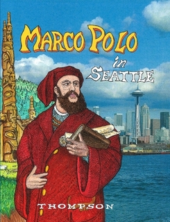
Marco Polo in Seattle tells the story of the Polo Brothers Spy team. Nicolo, Maffeo, and Marco were sent by Pope Innocent IV to China in order to learn the secrets of the Mongolian Emperor Kublai Khan. Marco was assigned the job of accompanying mapping expeditions to the American West Coast between 1280 and 1292. The Polos brought back to Venice maps of Alaska, California, and Peru – as well as plans for making the first muskets in Europe. Fully illustrated with maps, artifacts, ships, plant diffusion, legends, and maritime adventures. Suitable for young adults or general adult readers. 305 pages. Please purchase here or at lulu.com.
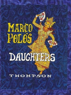 Marco Polo’s Daughters tells how Fantina, Bellela, and Moretta helped make their father’s book about the Orient a bestseller in Europe. Includes maps and letters about Marco Polo’s secret voyages to the New World. Marco’s secret voyages extended from Alaska and the Northwest Passage to the West Coast of Washington, Oregon, California, Mexico and Peru. Fully illustrated with maps, artifacts, ships, plant diffusion, legends, and maritime adventures. Suitable for young adults or general adult readers. 395 pages. Please purchase here or at lulu.com.
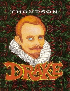
Francis Drake & the Port Townsend Mystery tells how the English privateer explorer sailed along the West Coast of America using a clock to prepare a navigational chart. This map is the earliest scientific map of the West Coast. Drake explored the Salish Sea (or Strait of Juan de Fuca) as a possible site for a new colony. Then he sailed on to San Francisco Bay where he left behind a third of his crew. Fully illustrated with maps, artifacts, ships, plant diffusion, legends, and maritime adventures. Suitable for young adults & general adult readers. 227 pages. Please purchase here or at lulu.com.
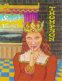
Secret Voyages has chapters on the female pharaoh, Hatshepsut, King Solomon, Marco Polo, the Franciscan Friar Nicholas of Lynn, Chinese Admiral Zheng He, the Portuguese Spy – Martin Behaim, and the Nordic adventurer Roald Amundsen. These vignettes reveal that maps, artifacts, and other clues can enable us to reconstruct ancient voyages that were kept secret due to the importance of geographical information to medieval societies. Fully illustrated with maps, artifacts, ships, plant diffusion, legends, and maritime adventures. Suitable for young adults or general adult readers. 305 pages. Please purchase here or at lulu.com.
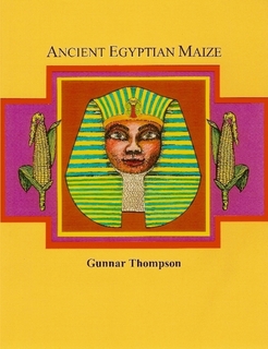
Ancient Egyptian Maize tells the story of how the New World crop spread all over the planet prior to the voyages by Columbus and other Renaissance Europeans. Several chapters highlight voyages by Egyptian traders to the mysterious Land of Punt. The principal sponsor of these expeditions was the female Pharaoh, Hatshepsut. Fully illustrated with maps, artifacts, ships, plant diffusion, legends, and maritime adventures. Suitable for young adults or general adult readers. 205 pages. Please purchase here or at lulu.com.
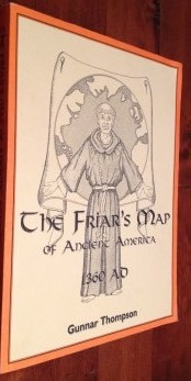
The Friar’s Map of North America 1360 AD
Did Monks come to America before Columbus? Like New condition published in 1996.

Very Good++ condition published in 1998 and signed by the author. Also available a Like New condition copy.

Good+ condition hardcover and dustjacket published in 1989. Also availble is a Very Good condition copy with a Good+ dustjacket.

The Diffusion Issue
George F. Carter, Stephen C. Jett, Gunnar Thompson, James Brett, Donald L. Cyr
Very Good+ condition published in 1991, written by incredible men.
Internet sources, video & audio tapes, & free video presentations U-Tube, Laura Lee—“Conversations for Exploration,” History Channel—“Uncovering the Past” with Scott Wolter, Dr. Bob Hieronimus, Atlantic Conference, Paths Across the Pacific, Phoenix Television—Hong Kong, Coast-to-Coast Radio, 21st Century Radio, Ancient American Books, Amazon.com Books.

American Discovery – Reclaiming Our Multicultural Heritage The Key to the Future – VHS
Running time approximately 2 hours. VHS tape produced in 2000, full color. Expert Gunnar Thompson is the presenter of this incredibly detailed compilation of evidence supporting oceanic travel in ancient America.
Gunnar’s website: www.marcopoloinseattle.com